A significant mistake made on greenfield sites across the Southland Plains is assuming uniform ground conditions beneath the topsoil. In Invercargill, where the Waihopai River and Oreti River systems have deposited complex sequences of gravels, silts, and peat over millennia, lateral changes over just 20 metres can shift a shallow foundation design from straightforward to high-risk. Seismic tomography provides a continuous velocity profile of the subsurface, mapping these transitions before a single borehole is advanced. When the MASW survey indicates a low Vs30 profile near the New River Estuary, we follow with refraction tomography to delineate the depth to competent gravels, ensuring foundation recommendations account for the buried paleochannels that crisscross the city.
Seismic velocity contrasts of 300 m/s versus 1,200 m/s separate compressible peat from dense gravel—a boundary that boreholes alone often miss between sampling points.
Methodology applied in Invercargill
Local geotechnical conditions in Invercargill
Invercargill sits at just 6 metres above mean sea level near the city centre, with groundwater often encountered within 1.5 metres of the surface. This shallow water table, combined with the peat lenses mapped by GNS Science across the Southland Syncline, creates conditions where seismic velocities below 200 m/s are not uncommon. Failing to identify these low-velocity zones leads to differential settlement that can crack slab-on-grade floors within the first five years of construction. Seismic tomography mitigates this by delivering a spatially continuous velocity model, rather than relying on point-source borehole logs, allowing engineers to position foundations away from buried compressible troughs and to design ground improvement—such as stone columns—only where the tomogram confirms it is genuinely required.
Our services
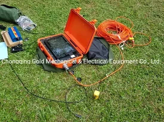
Our tomography surveys in Invercargill are configured to address the specific subsurface challenges of the Southland region.
Seismic Refraction Tomography
P-wave refraction surveys using 24- or 48-channel spreads to map depth to engineering rock and identify low-velocity zones in alluvial deposits. Ideal for residential subdivisions and commercial site investigations where bedrock depth is the primary unknown.
Seismic Reflection Profiling
High-resolution SH-wave reflection for deeper targets beyond 40 metres. Applied along the Tiwai Peninsula and industrial sites where stratigraphic continuity must be confirmed across distances of 200 metres or more.
Integrated Geophysical Site Characterisation
Combined seismic tomography with MASW and electrical resistivity, calibrated against CPT data, to produce a comprehensive ground model that addresses liquefaction susceptibility, bearing capacity, and excavation stability in a single report.
Quick answers
What depth can seismic tomography reach in Invercargill's saturated soils?
Refraction tomography typically resolves layers down to 30–40 metres in Southland's alluvial environment, though high attenuation in saturated silts can reduce penetration if the water table is exceptionally shallow. Reflection tomography, using shear-wave sources, extends the investigation to 80–120 metres, which is sufficient to image the contact with the underlying basement greywacke.
How much does a seismic refraction survey cost for a typical Invercargill section?
For a standard residential or light commercial site in Invercargill, seismic refraction tomography surveys range from NZ$4,790 to NZ$9,900 depending on the number of profiles, the required depth of investigation, and whether reflection lines are added to resolve deeper stratigraphy.
Can seismic tomography replace boreholes for foundation design?
Seismic tomography complements boreholes rather than replacing them entirely. The method provides continuous spatial coverage between borehole locations, identifying lateral variations that point-source logs miss. NZGS guidelines recommend combining geophysical methods with targeted drilling; we typically calibrate tomographic profiles with at least one borehole or CPT sounding to convert seismic velocities into engineering parameters.