NZS 3404 doesn't leave much room for guesswork when you're cutting deep into Invercargill's river silts. The Southland ground here is young, saturated, and reacts fast to stress relief. Our lab team has spent enough time on sites from the inner city rebuilds to the Tiwai supply chain upgrades to know that monitoring isn't a paperwork exercise. It's the difference between a controlled excavation and a Sunday morning call you don't want. We set up inclinometers against the shoring, read piezometers through the tide cycles, and watch vibration levels whenever a rock breaker fires up near an old brick party wall. The CPT test data we pull beforehand often dictates where the monitoring focus sits, especially when the New River Estuary muds show up higher in the profile than the desktop study suggested.
When the water table in Southland rises half a metre overnight, your inclinometer baseline from yesterday is already history.
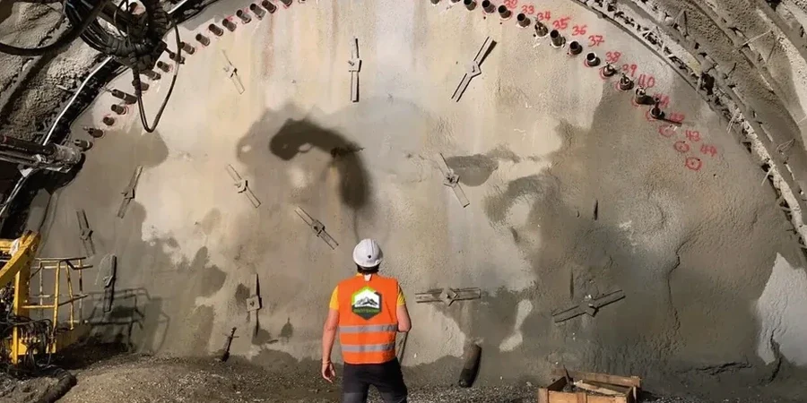
Methodology applied in Invercargill
Local geotechnical conditions in Invercargill
Invercargill sits on deep alluvial gravels and silts laid down by the Oreti and Makarewa Rivers, capped with soft estuarine deposits closer to the coast. The water table here can sit less than two metres below ground in the flat industrial land east of the city centre. That means a temporary excavation in winter is effectively a bathtub waiting to be filled. The risk isn't catastrophic collapse in most cases. It's incremental wall deflection that goes unnoticed until the shoring system loses its pre-stress and the adjoining pavement starts to crack. We've seen projects where a week of unmonitored groundwater rise undid three weeks of careful bench cutting. The New Zealand Geotechnical Society guidelines spell it out clearly: observational method needs actual observation. Without regular inclinometer and piezometer data, you're just hoping the geology plays nice.
Our services
Our monitoring work in Invercargill covers the two fronts that matter when you're down in the cut: structural movement and water pressure. Both run on the same timeline as the dig.
Deep excavation monitoring
Continuous inclinometer and piezometer readings tied to the design deflection limits. We track shoring wall movement, soldier pile tilt, and groundwater fluctuation through the excavation sequence, with daily reports that flag any drift beyond the trigger values.
Vibration and settlement monitoring
Triaxial geophone arrays and settlement pins installed on adjacent structures. Used when rock breaking or heavy compaction runs close to heritage buildings in the city centre or sensitive equipment at the aluminium smelter.
Quick answers
How much does geotechnical excavation monitoring cost for a standard Invercargill commercial dig?
For a typical commercial excavation in Invercargill with inclinometer casing, piezometer installation, and daily monitoring over a three to four week dig, budget between NZ$1.600 and NZ$3.790. The spread depends on how many monitoring stations you need and whether vibration monitoring gets added for adjacent structures.
When does NZS 3404 require inclinometer monitoring on an excavation?
NZS 3404 brings monitoring into play when the shoring system forms part of the temporary works and the design relies on the observational method. If your geotechnical report flags soft ground, high groundwater, or a retained height over about three metres in Invercargill's silts, the engineer will almost always specify inclinometer verification to confirm the wall performance matches the design assumptions.
What triggers a stop-work in your monitoring protocol?
We set trigger values with the design engineer before the dig starts. A typical amber alert fires when wall deflection hits 80 percent of the design envelope or when pore pressure jumps more than 20 percent above the baseline in a 24-hour window. If those thresholds breach, we call it immediately and the site pauses until the shoring design is reviewed.
How do you handle monitoring when groundwater levels fluctuate with the tides near the estuary?
In the estuarine fringe around the New River, we install barometric compensation on the piezometer dataloggers to strip out tidal and atmospheric noise from the pore pressure signal. That way we can separate a genuine soil response from a routine tidal swing, which in this part of Invercargill can move the water table by half a metre in a few hours.